Advanced Aerial Imaging for Better Inspection, Documentation, and Decision-Making
Infrared and thermal drone imagery gives businesses, property owners, engineers, contractors, facility managers, and marketing teams a powerful way to see conditions that are not always visible through standard photography or video. While traditional aerial video is excellent for visual storytelling, site documentation, and promotional content, thermal and infrared drone imaging can add another layer of practical intelligence to a project.
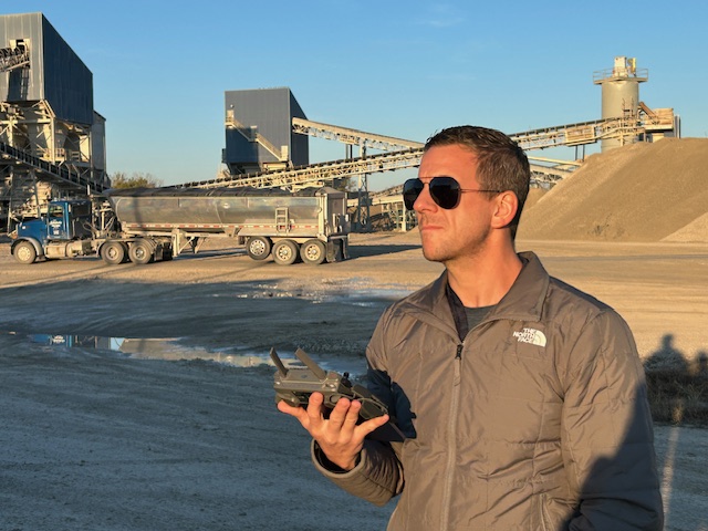
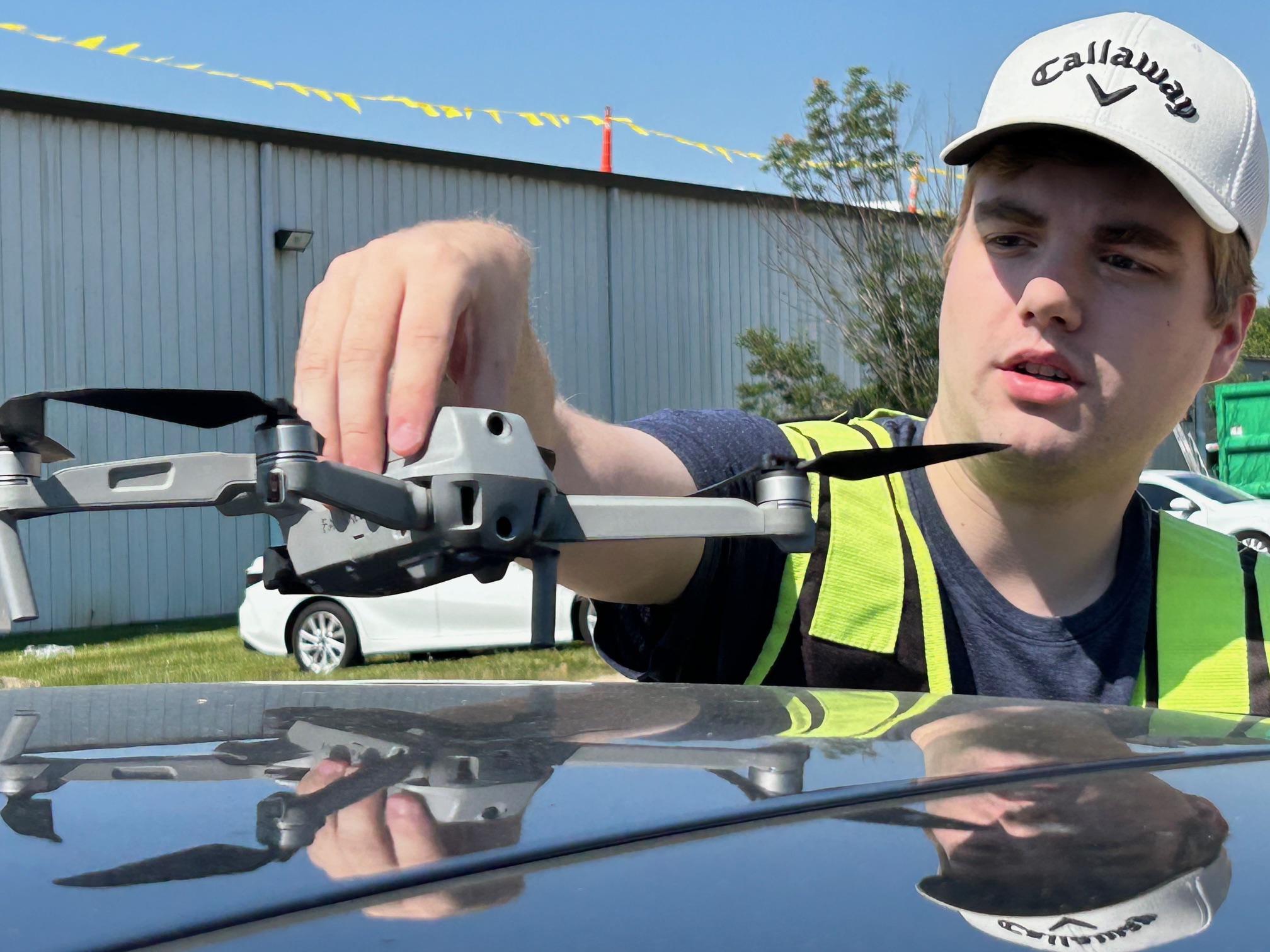
At St Louis Video Production Studio, we use drone imagery as part of a broader professional production and documentation process. For many commercial, industrial, construction, real estate, and facility-related projects, drones can help capture valuable visual information from angles that are difficult, time-consuming, or unsafe to reach by ladder, lift, rooftop access, or ground-based inspection alone.
Infrared and thermal drone projects are not just about flying a drone and collecting images. They require planning, proper environmental conditions, experienced operators, appropriate equipment, and a clear understanding of how the imagery will be used. The goal is to create useful visual assets that support better communication, inspection, analysis, marketing, reporting, and decision-making.
What Is Thermal Drone Imaging?
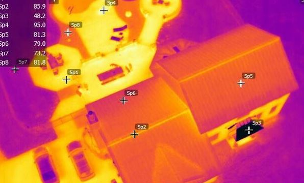
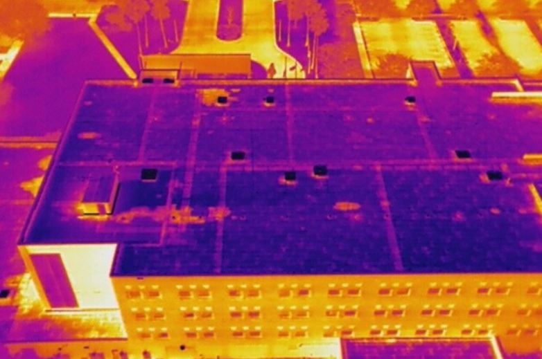
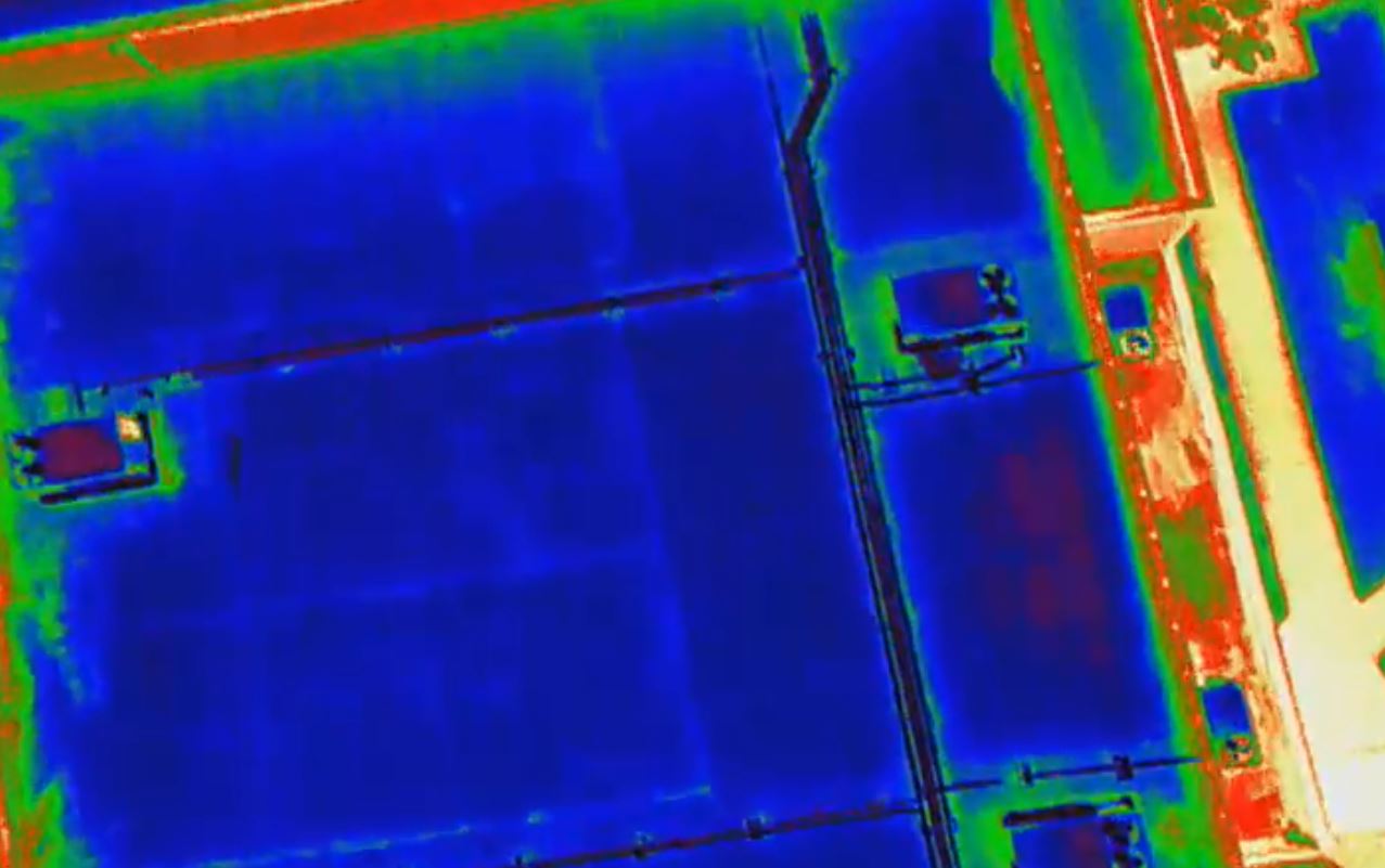
Thermal drone imaging uses specialized sensors to detect temperature differences on surfaces. Instead of recording only visible light, thermal cameras detect infrared radiation and translate temperature variations into visual imagery.
This can be especially useful when a project requires identifying heat loss, moisture concerns, roof anomalies, equipment overheating, insulation issues, energy inefficiencies, or temperature differences across a structure or site.
Thermal drone imagery can help document:
Roof conditions and possible moisture intrusion
Building envelope performance
Heat loss around windows, doors, and exterior walls
Mechanical equipment temperature differences
Solar panel inspection concerns
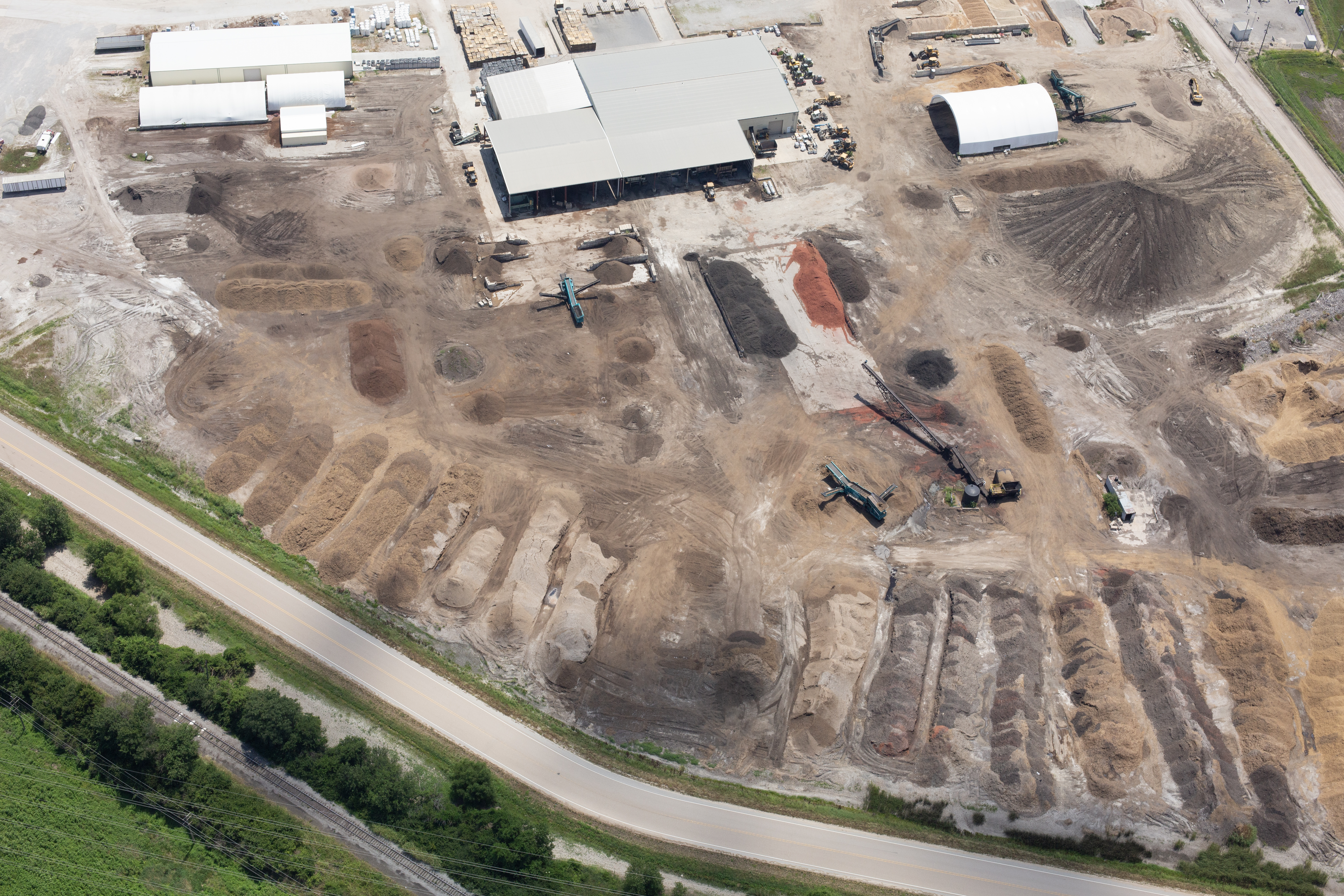
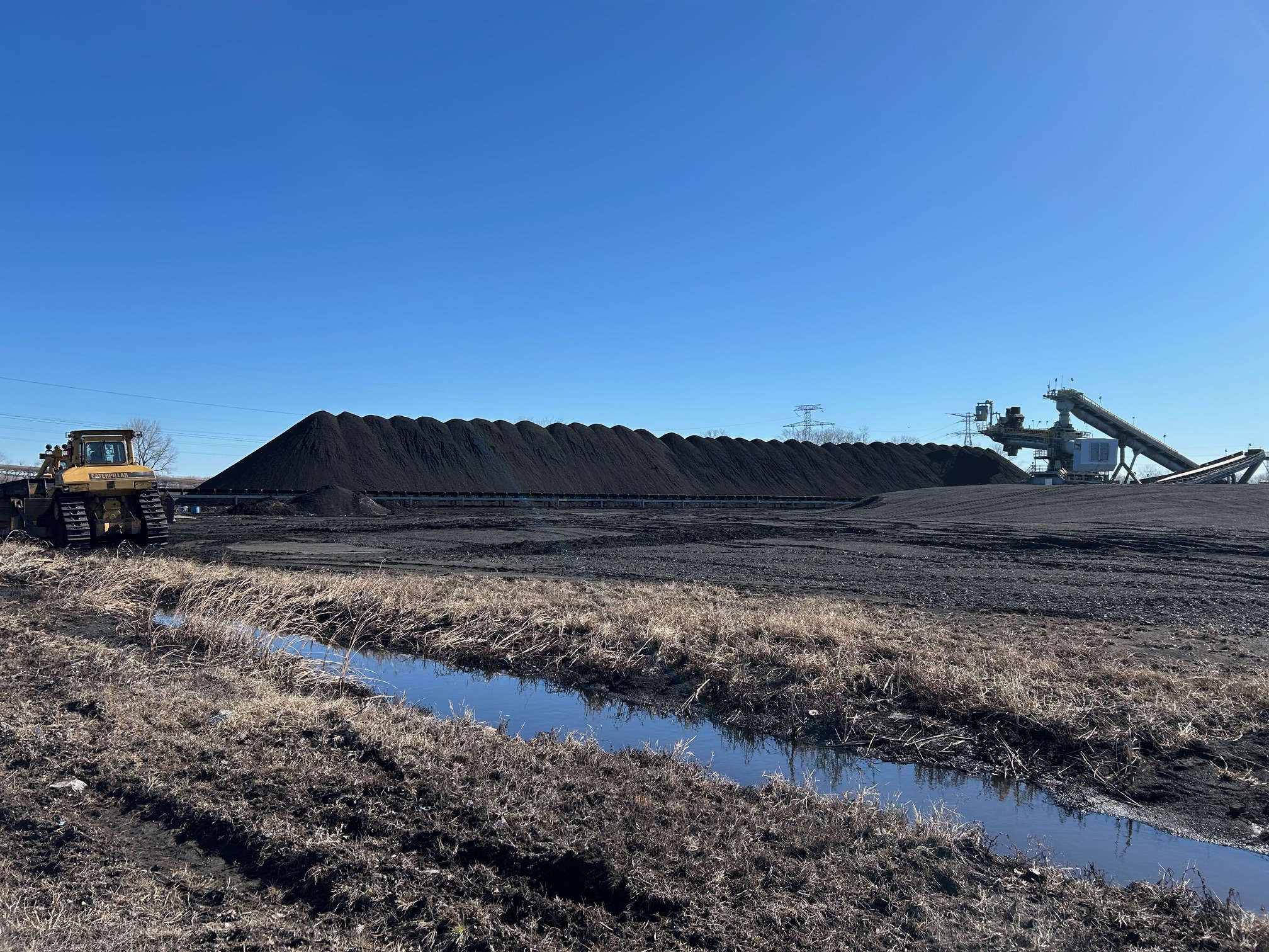
Industrial and utility site conditions
Pavement, infrastructure, and facility observations
Large property or campus documentation
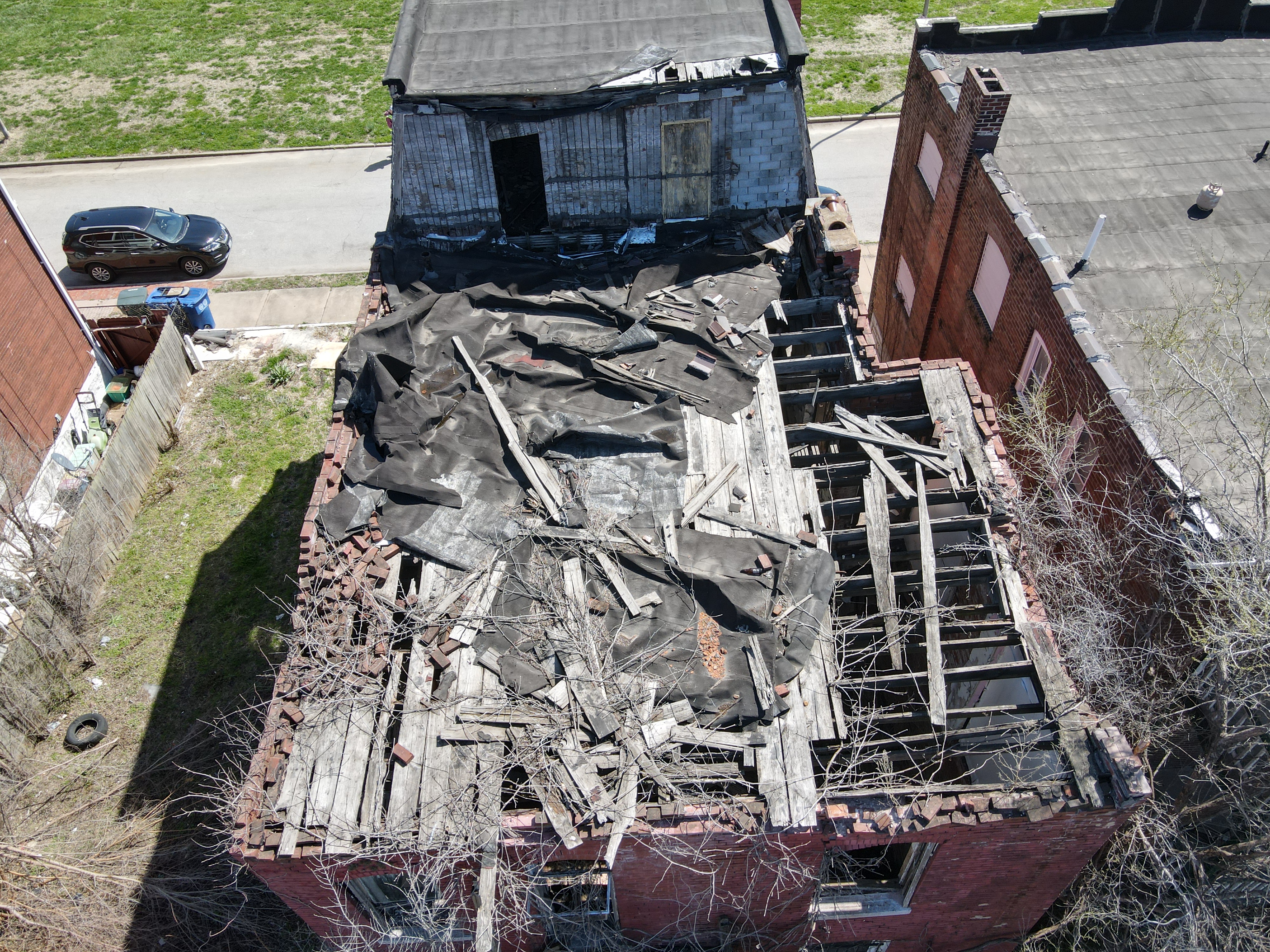
Construction progress and site monitoring
Thermal imagery is not a replacement for engineering analysis, laboratory testing, or certified inspection work when those are required. However, it can be an extremely valuable visual documentation tool that helps identify areas needing closer review.
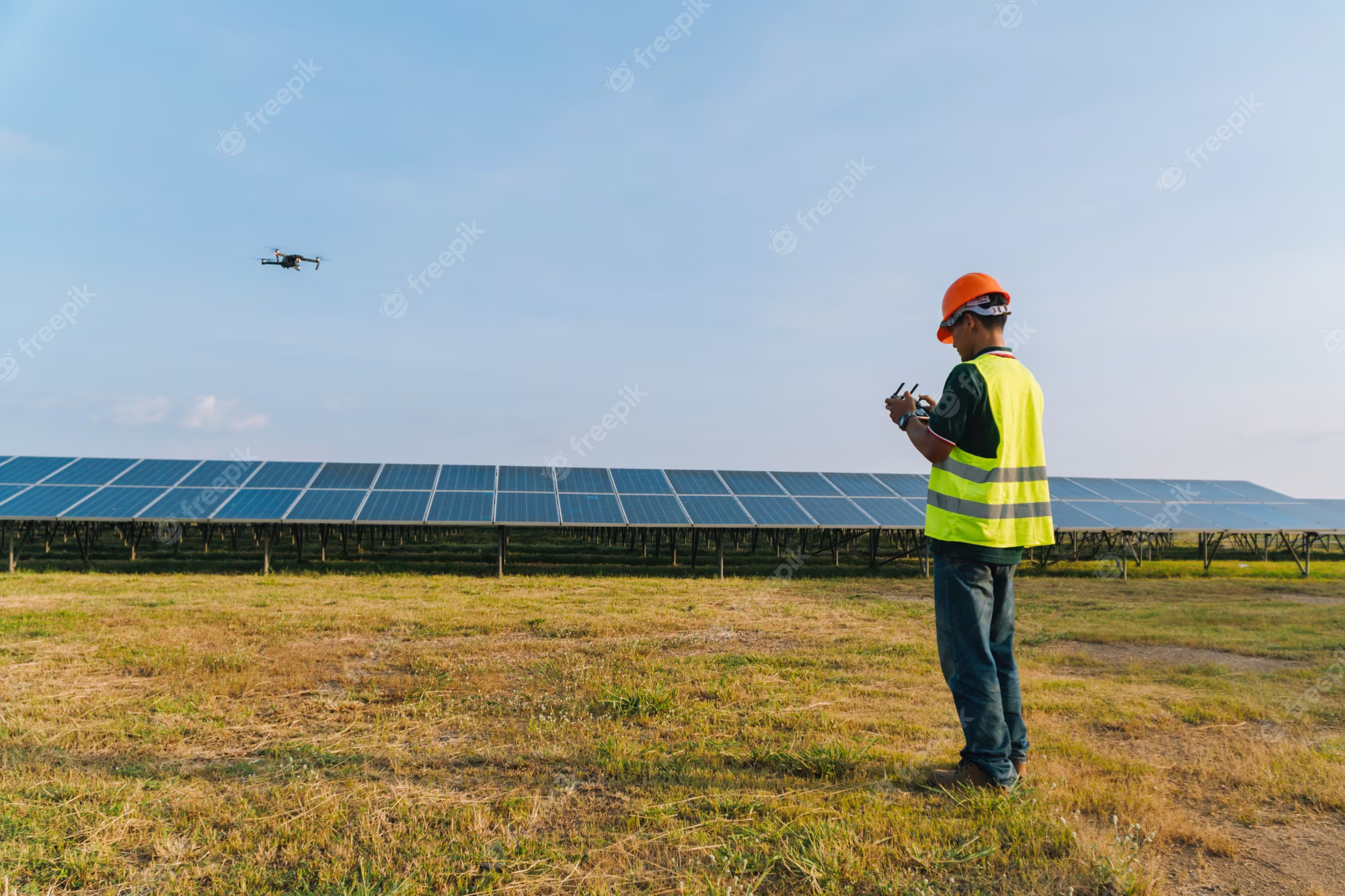
Why Drones Are Effective for Infrared and Thermal Projects
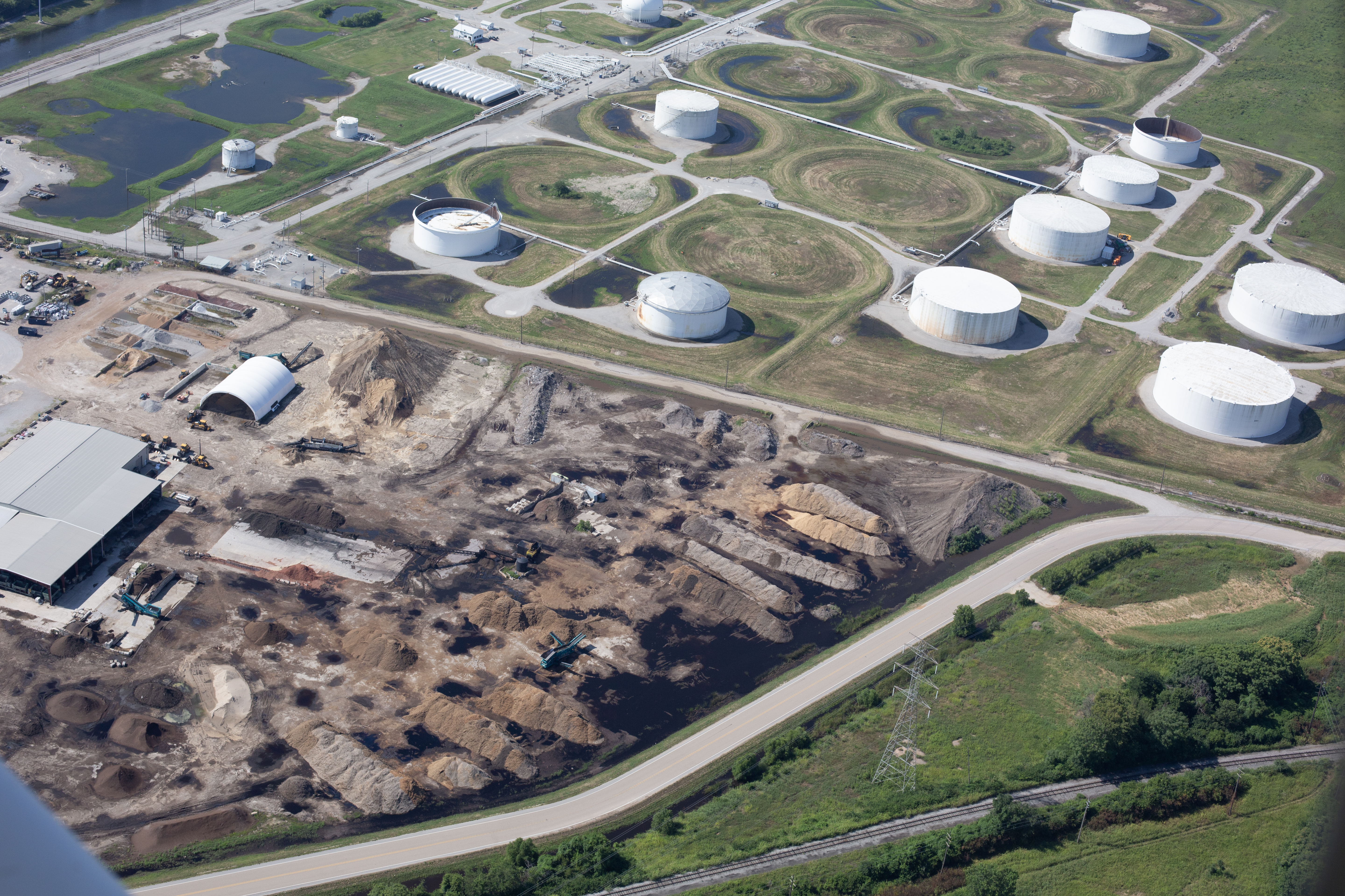
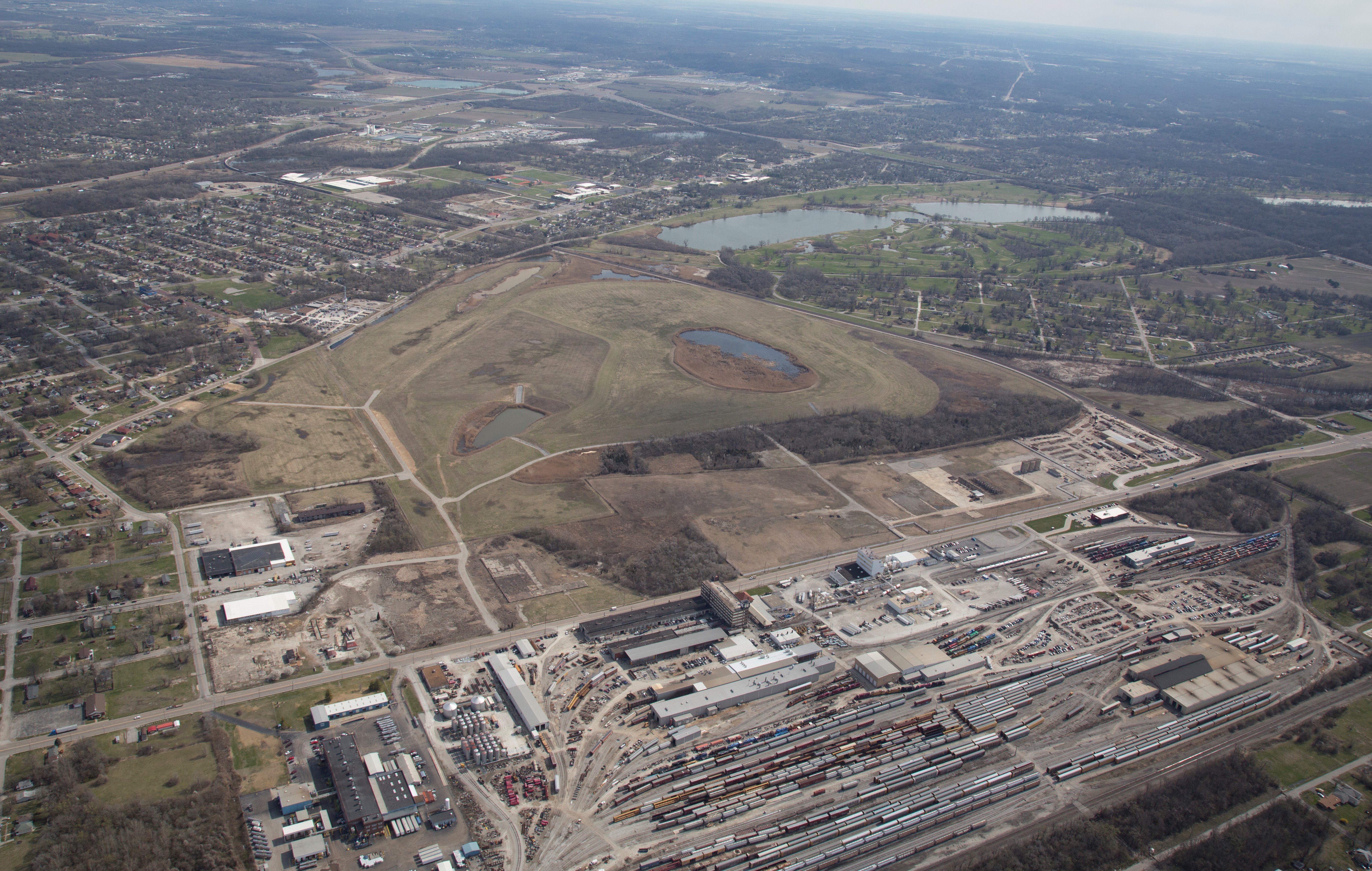
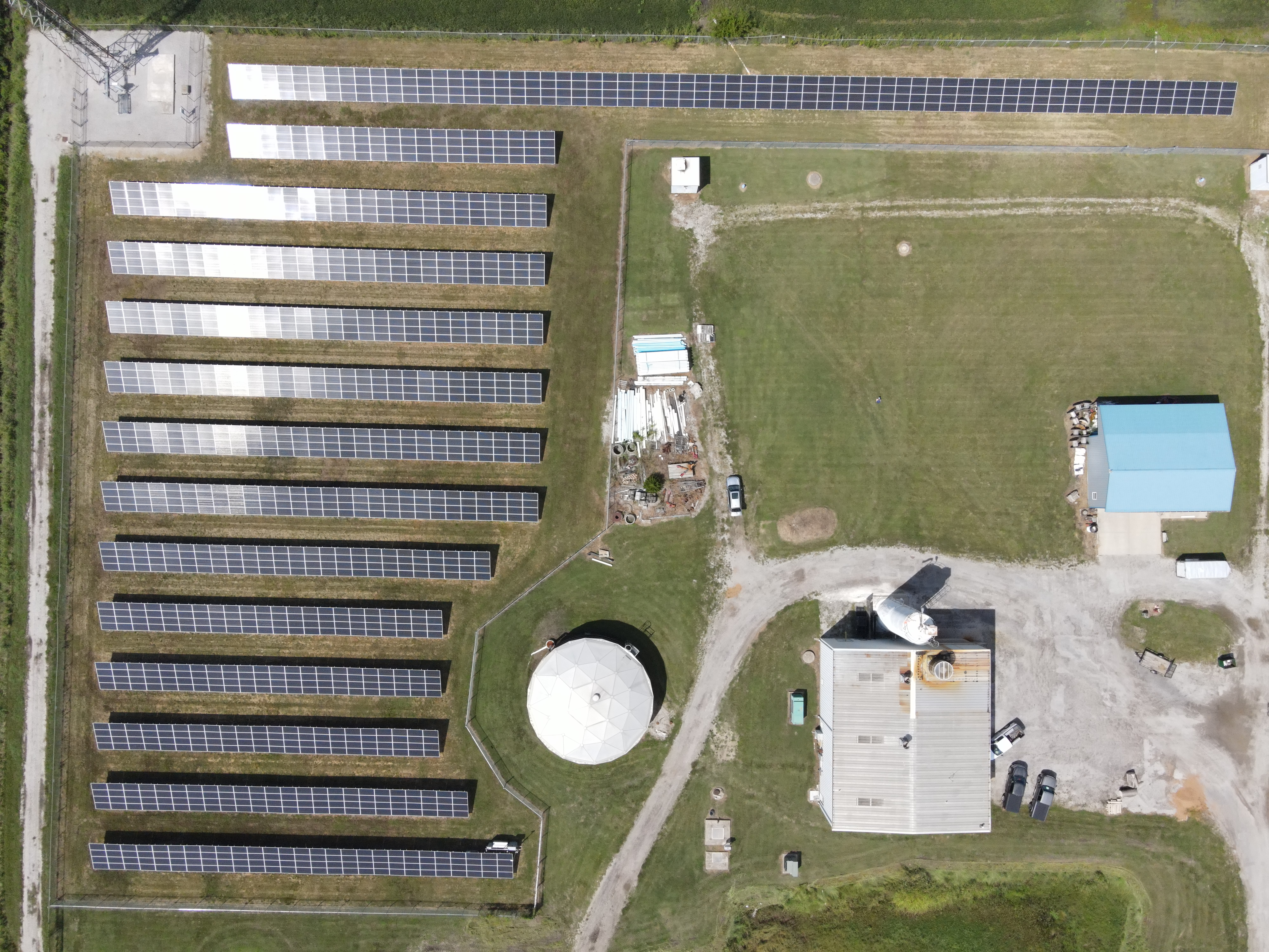
Drones are particularly useful for infrared and thermal work because they can cover large areas quickly and capture imagery from elevated and difficult-to-reach perspectives. This is especially important for roofs, commercial buildings, industrial sites, warehouses, schools, hospitals, churches, municipal properties, and large corporate campuses.
A drone can inspect or document areas that would otherwise require lifts, scaffolding, ladders, rooftop crews, or extended time on-site. This can reduce disruption, improve safety, and provide a more complete visual overview.
For many decision makers, the greatest value is perspective. Thermal and infrared drone imagery can show patterns across an entire structure or property, not just isolated problem areas. That makes it easier to communicate findings to owners, managers, contractors, insurers, engineers, and internal stakeholders.
Common Business Uses for Thermal and Infrared Drone Imagery
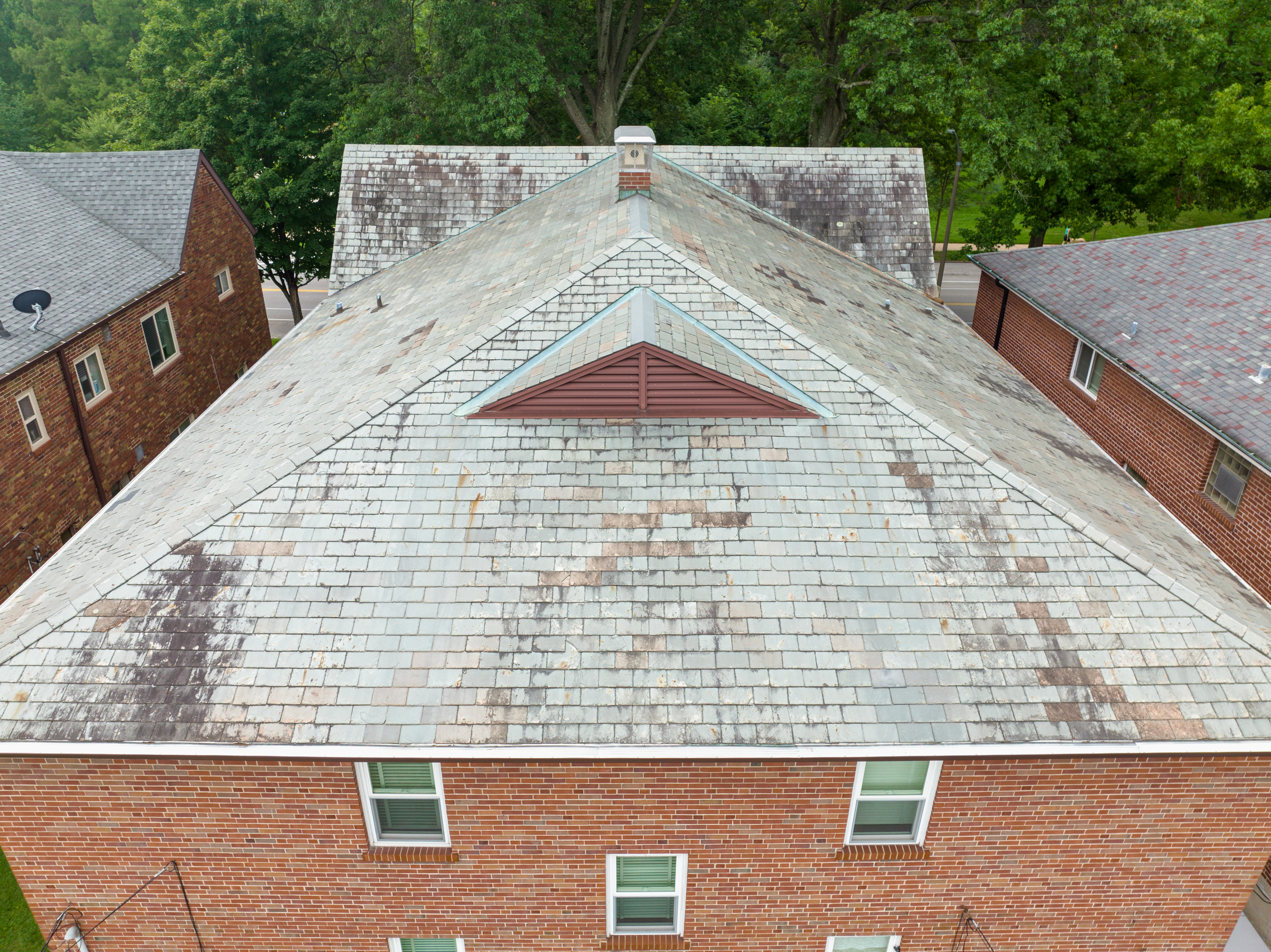
Commercial Roof Documentation
Flat and low-slope commercial roofs are common candidates for thermal drone imagery. Under the right conditions, thermal differences can sometimes help identify areas where moisture may be trapped beneath roofing materials. These patterns can then be reviewed by roofing professionals or building consultants.
This type of imagery can be helpful for maintenance planning, repair documentation, warranty discussions, capital improvement planning, and pre-renovation assessments.
Building Envelope and Energy Loss Review
Thermal drone imagery can help visualize heat loss around exterior walls, windows, doors, rooflines, penetrations, and other building components. For businesses concerned about energy efficiency, tenant comfort, or aging building systems, this imagery can provide a useful starting point for further evaluation.
Industrial and Mechanical Observations
Industrial properties often include rooftop units, exhaust systems, production equipment, utility infrastructure, piping, storage areas, and exterior mechanical systems. Thermal imagery can help document abnormal heat patterns or temperature variations that may deserve closer inspection.
Solar Panel and Utility Site Documentation
Thermal drone imagery can help identify potential irregularities in solar panels, electrical components, and utility-related installations. When paired with standard aerial photography and video, thermal imaging can provide a more complete documentation package.
Construction and Development Projects
During construction, drones can document site conditions, progress, roofing installation, insulation-related concerns, and large-scale property changes. Thermal and infrared imagery can be especially useful when projects involve building performance, energy efficiency, or infrastructure documentation.
Real Estate, Facilities, and Property Management
For commercial real estate owners, property managers, and facility teams, drone imagery can support budgeting, maintenance planning, insurance documentation, investor communications, and capital improvement presentations.
The Importance of Timing and Conditions
Thermal drone projects require more planning than standard aerial photography. Temperature differences, sunlight, wind, cloud cover, roof material, surface moisture, time of day, and recent weather can all affect the usefulness of the imagery.
For example, roof thermal projects are often best conducted when there is a meaningful temperature transition, such as after sunset, when retained heat differences may become more visible. Other projects may benefit from early morning, overcast conditions, or specific temperature ranges.
The right conditions depend on the subject and the objective. That is why pre-production planning matters. Before flying, the production team should understand the site, the intended use of the imagery, safety concerns, airspace requirements, weather conditions, and deliverable expectations.
Standard Drone Imagery vs. Thermal Drone Imagery
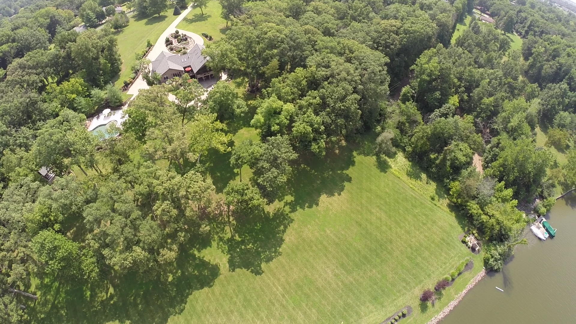
Standard drone photography and video capture what the eye can see: building exteriors, roof surfaces, site layout, progress, landscaping, traffic flow, construction details, and general property conditions.
Thermal imagery adds another layer by showing temperature variation. Used together, standard aerial imagery and thermal imaging can create a stronger documentation package.
For example, a roof report or facility presentation may benefit from both:
High-resolution aerial photography for visual reference
Thermal imagery showing temperature patterns
Video footage for orientation and site context
Ground-level photography for detail confirmation
Edited deliverables for presentation, reporting, or marketing use
This combined approach is often more useful than relying on one type of image alone.
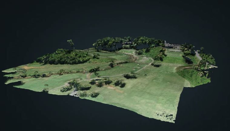
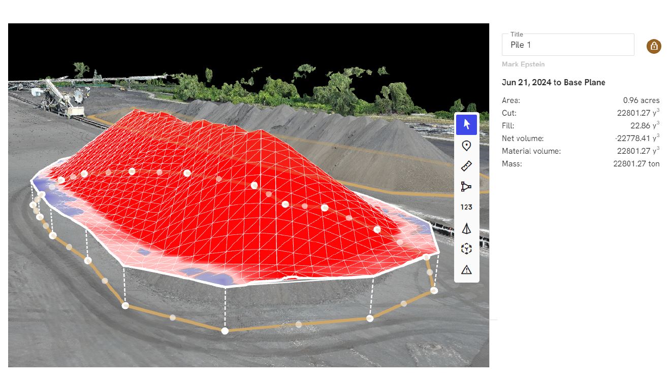
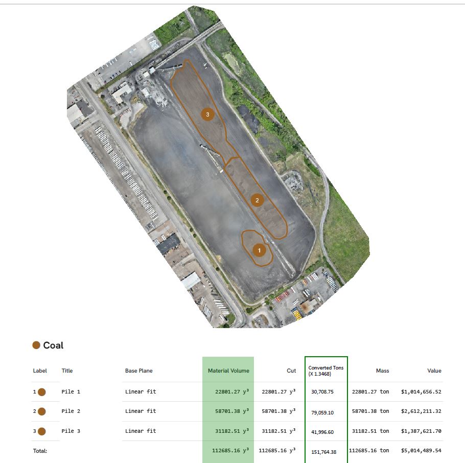
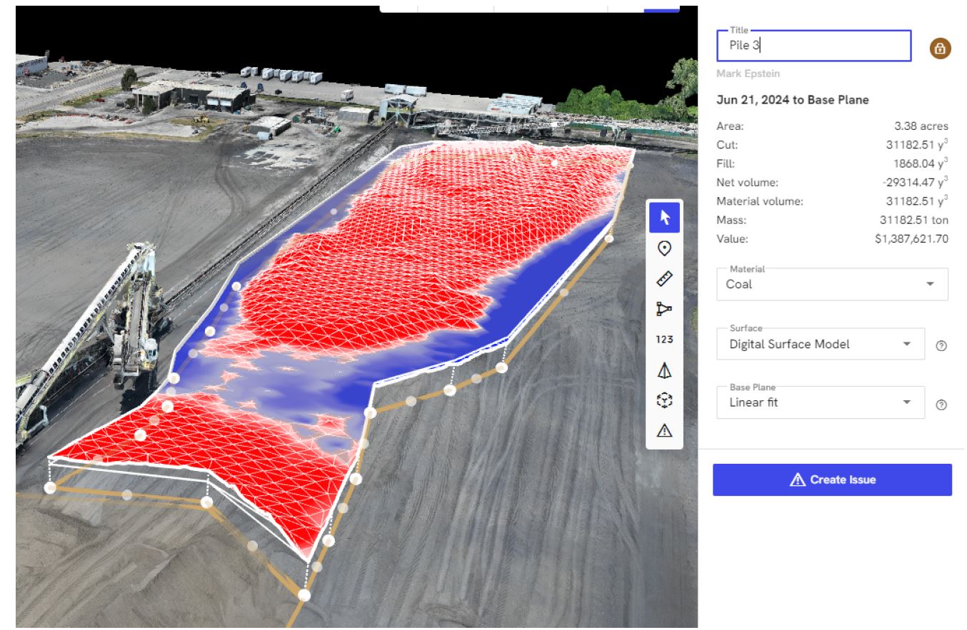
Orthomosaics, LiDAR, and Additional Drone Services
Infrared and thermal drone imagery is one part of a larger aerial imaging toolkit. Depending on the project, St Louis Video Production Studio can also support additional drone-based deliverables.
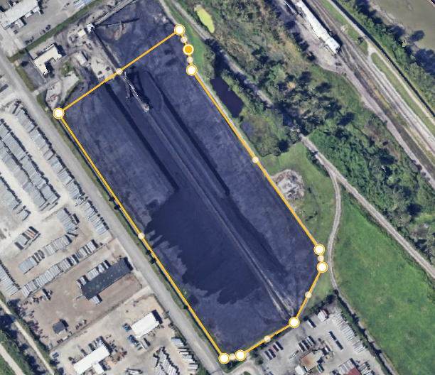
Orthomosaics
An orthomosaic is a detailed, map-like image created from many overlapping aerial photos. It can be useful for construction sites, land development, property documentation, roof planning, campus mapping, and large-scale visual records.
LiDAR
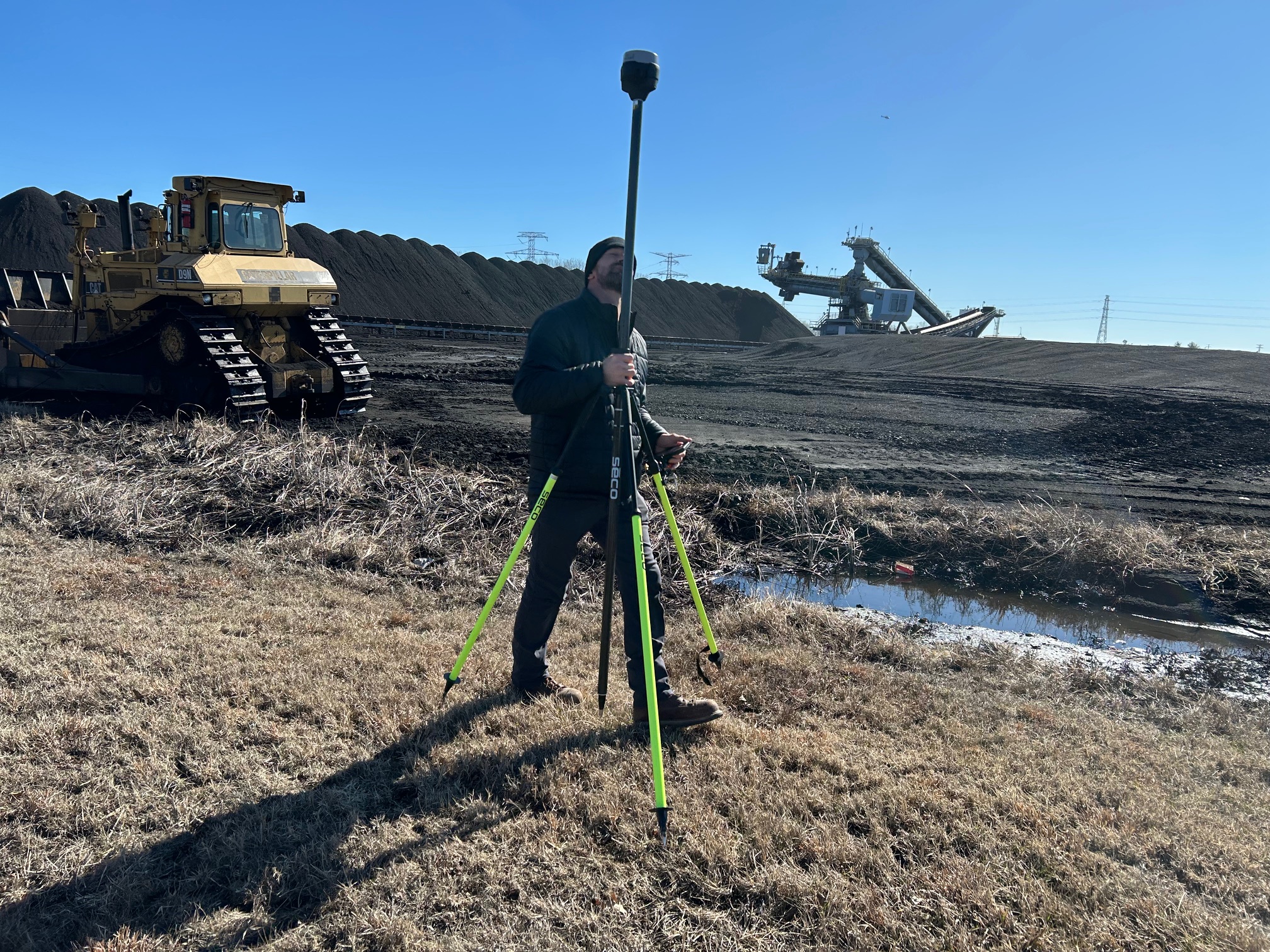
LiDAR uses laser-based measurement to capture highly detailed spatial data. For certain projects, LiDAR can be useful for terrain, structures, elevation, vegetation, site modeling, and measurement-related applications.
FPV Indoor Drone Footage
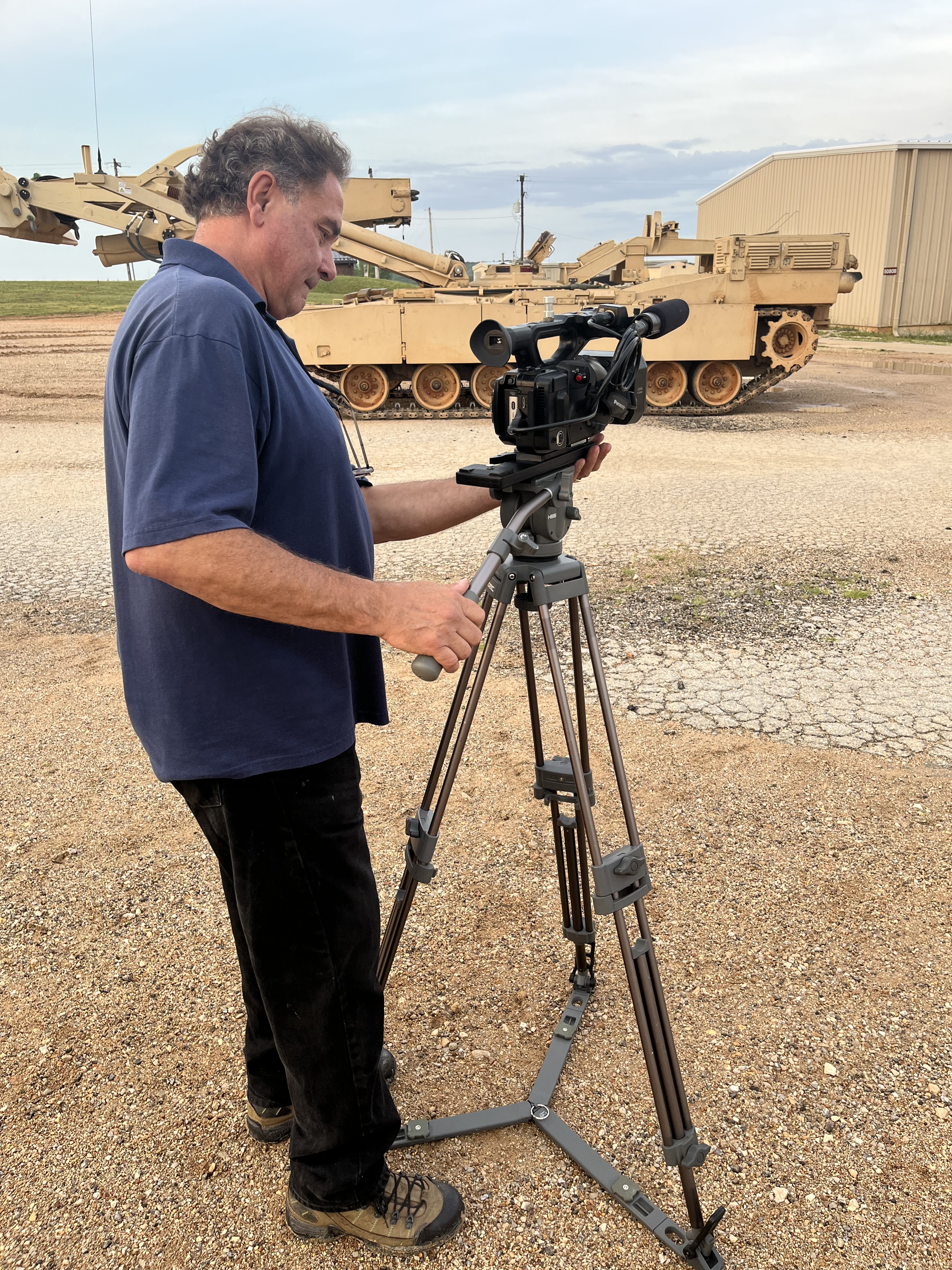
In addition to commercial drone imagery, we can fly specialized FPV drones indoors for dynamic video production. This is useful for manufacturing facilities, corporate campuses, warehouses, showrooms, event spaces, healthcare facilities, schools, and branded video tours where movement, energy, and perspective matter.
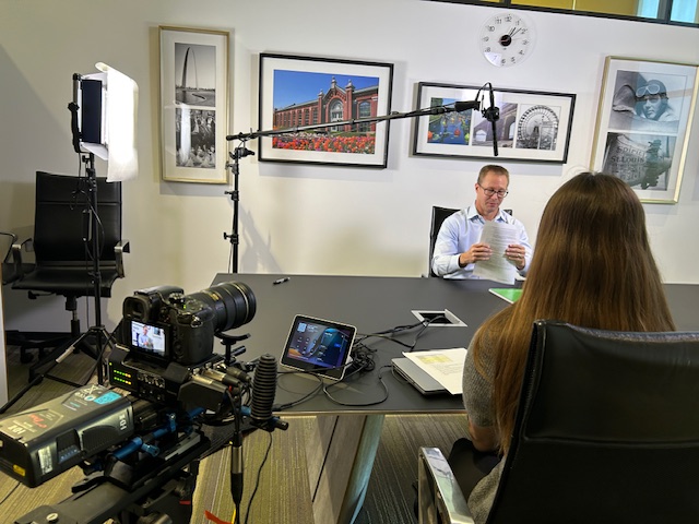
Why Professional Production Experience Matters
Thermal drone imagery is technical, but the final deliverable still has to communicate clearly. That is where production experience matters.
A business may need imagery for an engineering team, an insurance file, a marketing campaign, a board presentation, a construction update, a property listing, or an internal facilities review. Each use case requires different planning, framing, file handling, editing, labeling, and delivery.
As video producers and photographers, we approach drone projects with the final audience in mind. We consider how the footage will be used, who needs to understand it, and what supporting visuals may improve clarity.
A thermal image alone may show a temperature pattern. A well-produced package can include aerial context, close-up documentation, edited video, still images, labeled visuals, voiceover, interview footage, b-roll, maps, and supporting media assets that tell the larger story.
Planning a Drone Infrared or Thermal Project
Before any drone thermal project, it is important to define the objective. A useful pre-production discussion may include:
What property, structure, or site needs to be documented?
What problem or condition is being investigated?
Will the imagery be used for marketing, inspection, planning, reporting, or legal documentation?
Are there safety concerns, restricted areas, or access limitations?
Are standard aerial photos and video also needed?
What file formats and final deliverables are required?
Will engineers, roofers, contractors, or facility managers need the imagery?
Are there deadlines tied to construction, weather, insurance, or maintenance schedules?
The more clearly the project is defined, the more useful the final imagery will be.
Deliverables for Business and Marketing Use
Drone imagery can serve technical, operational, and marketing purposes at the same time. For example, a commercial building owner may need thermal imagery for maintenance planning, but also need aerial photography for marketing the property. A construction firm may want site documentation for project management, while also needing edited video for a case study or proposal.
St Louis Video Production Studio can help create deliverables such as:
Thermal image sets
Standard aerial photography
Edited aerial video
Project documentation footage
B-roll libraries
Before-and-after visuals
Facility overview videos
Construction progress media
Marketing reels and social media clips
Website and presentation imagery
Location scouting visuals
Interview and testimonial support footage
This is especially useful for businesses that want one production partner to handle both technical documentation and polished marketing content.
Better Visual Intelligence for Better Communication
Decision makers often need to explain complex property, facility, construction, or infrastructure issues to people who are not physically on-site. Drone imagery helps bridge that gap.
Infrared and thermal visuals can make invisible or hard-to-explain conditions easier to understand. Standard aerial video can show scale and context. Ground-level photography can confirm details. Edited video can organize the story. Together, these assets help teams communicate more effectively.
That is the real advantage of professional drone imagery: it gives stakeholders a clearer visual record, a better way to evaluate conditions, and stronger media assets for future use.
St Louis Video Production Studio: Full-Service Drone, Video, and Photography Production
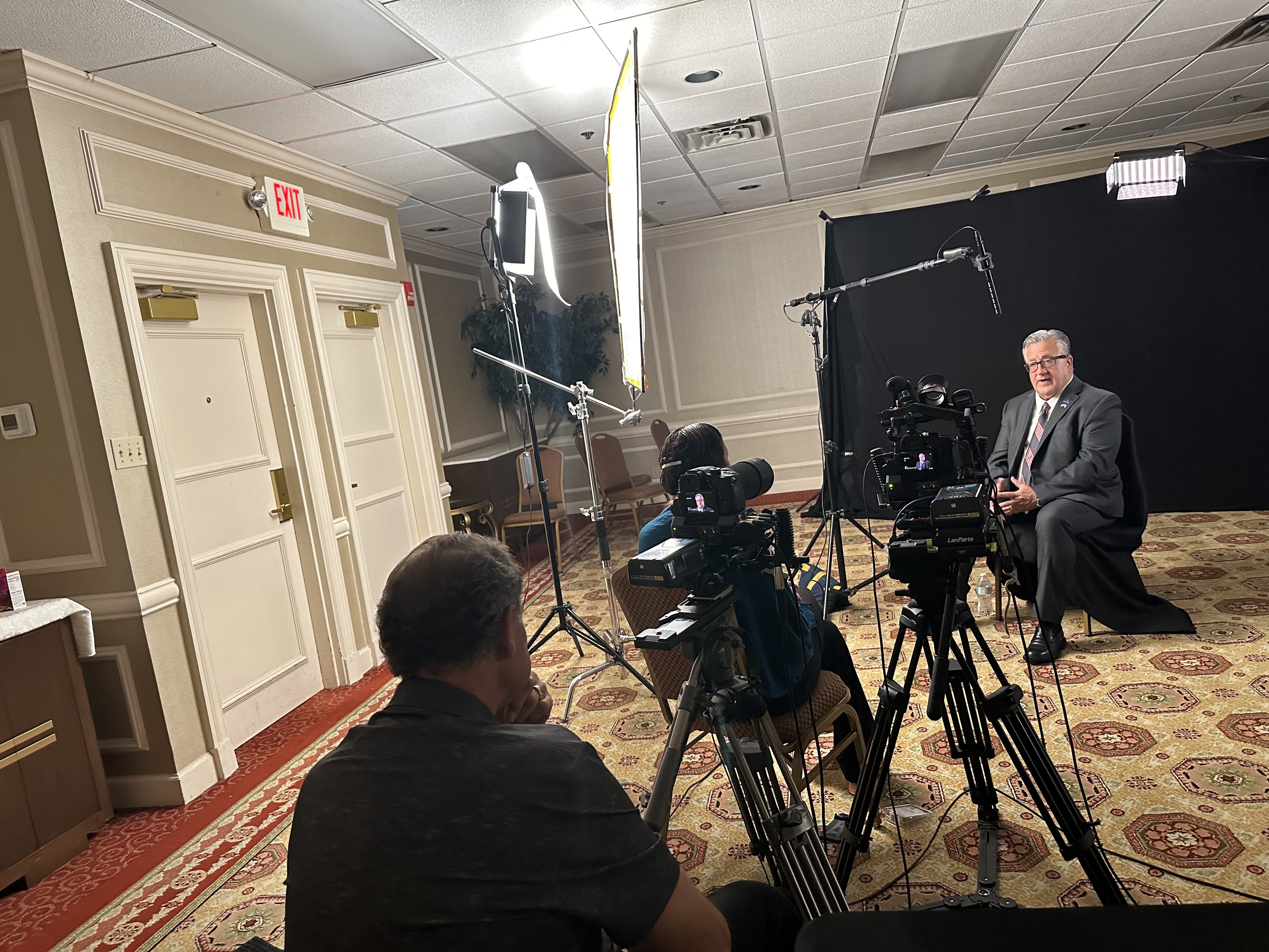
St Louis Video Production Studio is a full-service professional commercial photography and video production company with the right equipment and creative crew service experience for successful image acquisition. We offer full-service studio and location video and photography, as well as editing, post-production, and licensed drone services.
St Louis Video Production Studio can customize your productions for diverse types of media requirements. Repurposing your photography and video branding to gain more traction is another specialty. We are well-versed in all file types and styles of media and accompanying software. We also use the latest in Artificial Intelligence for our media services to support efficient production, organization, editing, and content development.
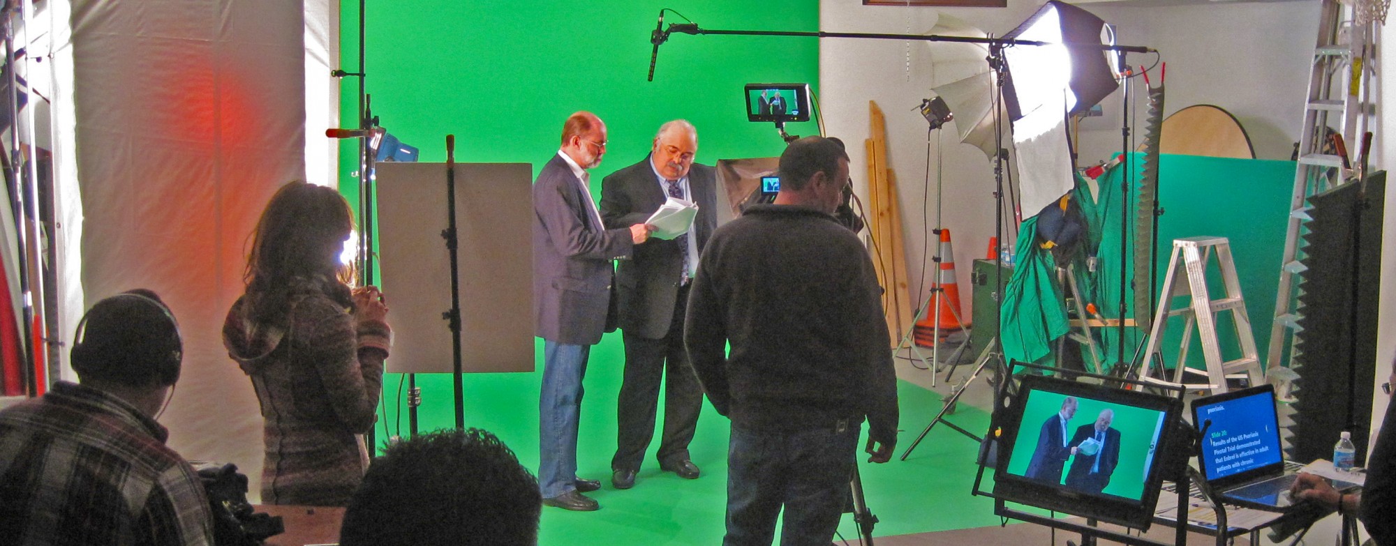
Our private studio lighting and visual setup is perfect for small productions and interview scenes. Our studio is large enough to incorporate props to round out your set. We support every aspect of your production—from setting up a private, custom interview studio to supplying professional sound and camera operators, as well as providing the right equipment—ensuring your next video production is seamless and successful.
We are location scouting and b-roll specialists, and we can fly specialized FPV drones indoors for dynamic facility, commercial, and branded video productions. Other drone special services include infrared thermal imaging, orthomosaics, and LiDAR.
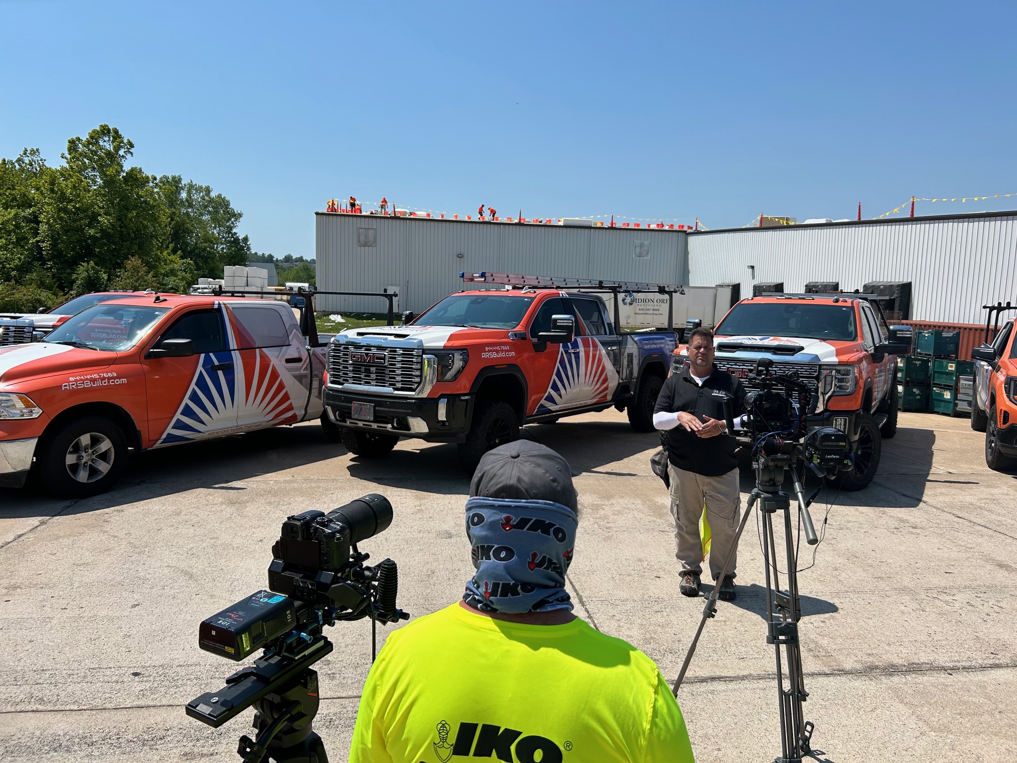
As a full-service video and photography production corporation since 1982, St Louis Video Production Studio has worked with many businesses, marketing firms, and creative agencies in the St. Louis area for their marketing photography and video. Whether your project requires infrared and thermal drone imagery, standard aerial video, commercial photography, studio interviews, location production, editing, or a complete media package, our experienced team can help plan, capture, and deliver the right visual assets for your business.
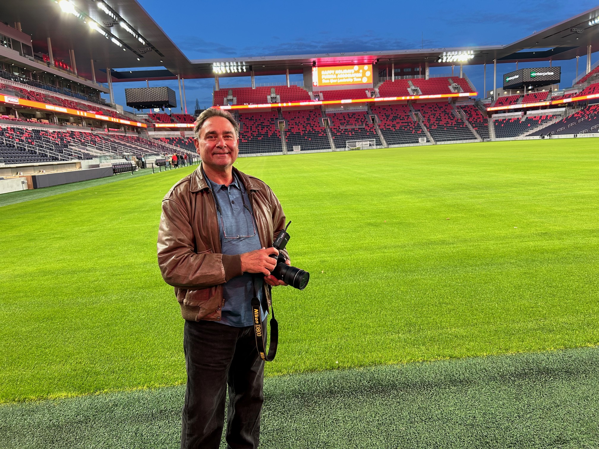
Rob Haller 314-604-6544
