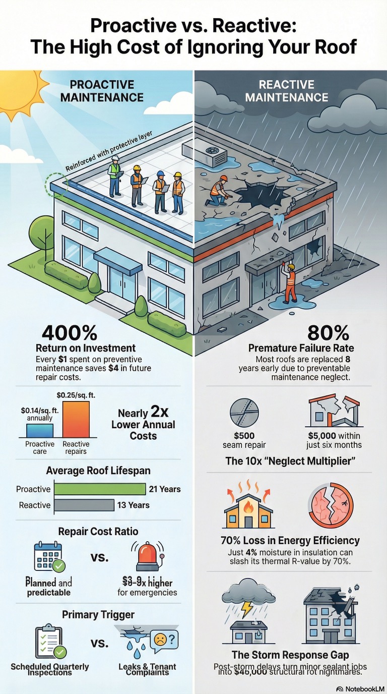
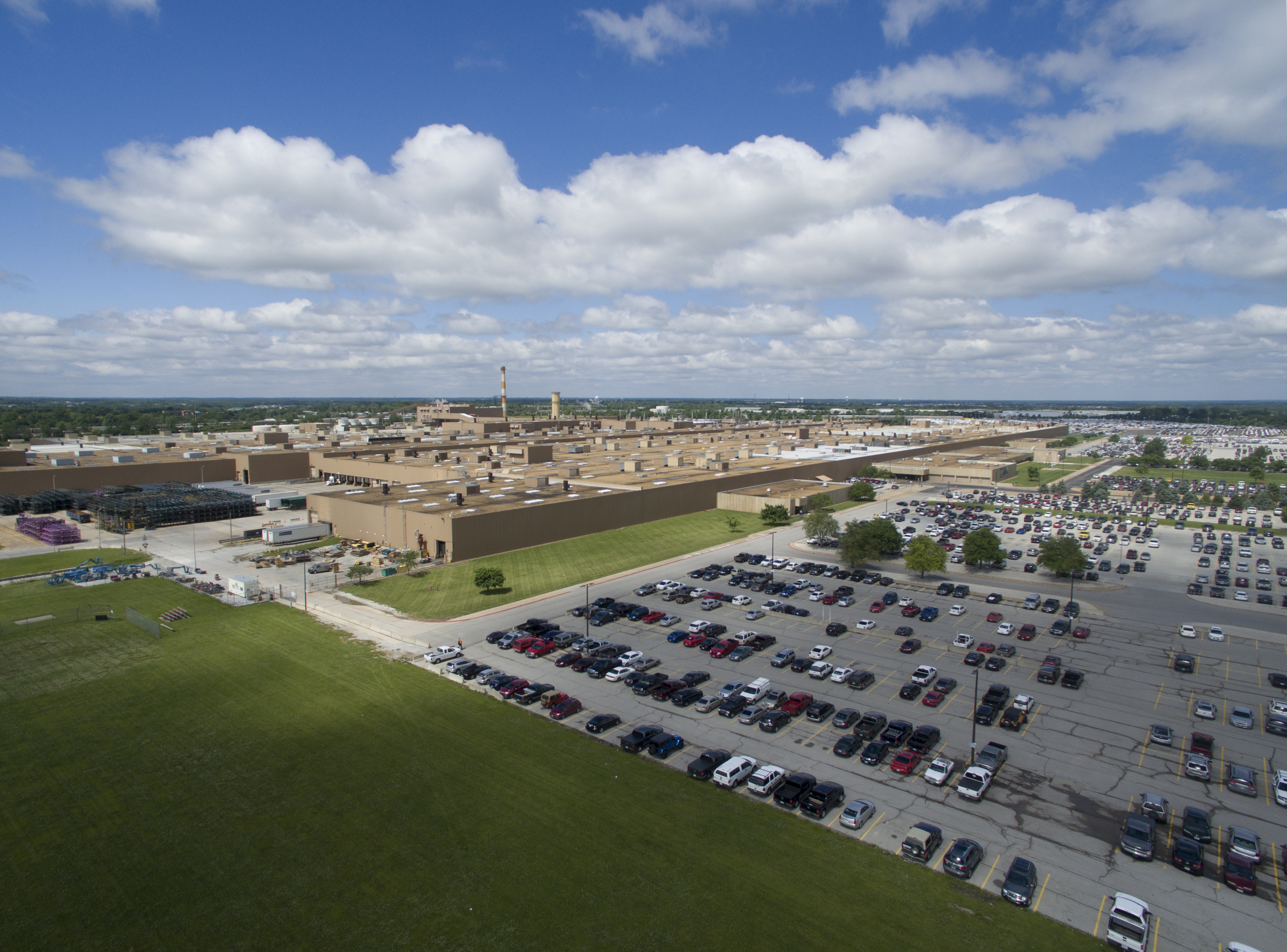
For businesses and organizations that manage buildings, land, infrastructure, industrial sites, and construction assets, drones have become far more than a visual content tool. They are now practical data-collection platforms that can reveal heat loss, moisture intrusion, roof anomalies, site conditions, elevation changes, surface measurements, and terrain detail with a speed and perspective that traditional ground-based methods often cannot match. In St. Louis, where commercial properties, industrial facilities, transportation corridors, utility infrastructure, and active development sites all present unique inspection and documentation demands, thermal and LiDAR drone services have become increasingly valuable.
For decision makers in marketing, operations, facilities, engineering, construction, and communications, understanding the difference between standard aerial imaging and advanced thermal and LiDAR drone capture is important. While conventional drone photography is excellent for visual storytelling, branding, progress images, and promotional media, thermal and LiDAR services produce a more specialized layer of information. They can help organizations identify issues, document conditions, improve planning, support maintenance decisions, and create visual assets that are both technically useful and strategically marketable.
Why Thermal and LiDAR Drones Matter
Most organizations are already familiar with the value of aerial video and photography. Aerial footage helps show property scale, site layout, access routes, surrounding development, and overall visual context. Thermal and LiDAR drones take that value much further by gathering information the naked eye cannot reliably detect.
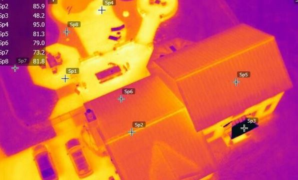
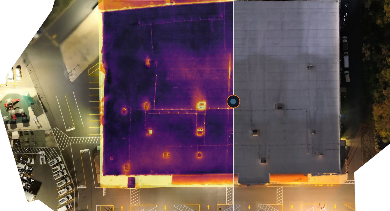
Thermal drones use infrared sensors to detect surface temperature differences. These differences can reveal conditions that are otherwise hidden in standard imagery, such as trapped moisture, insulation problems, overheating equipment, electrical anomalies, energy loss, and other heat-related inconsistencies. For many commercial and industrial applications, thermal imaging adds a diagnostic layer that can make drone operations far more useful than simple visual capture alone.
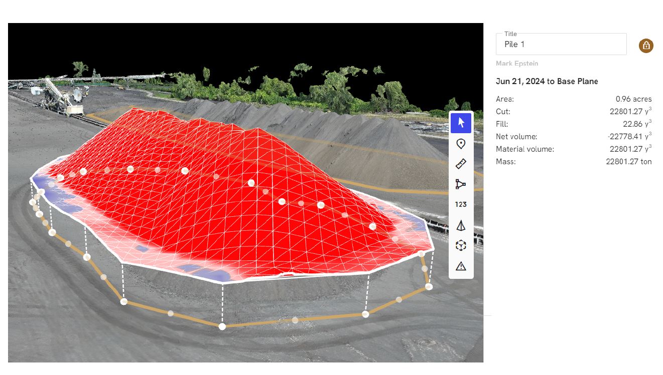
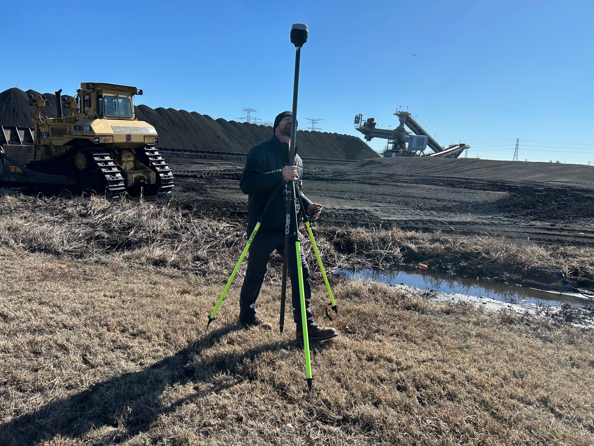
LiDAR, by contrast, uses laser pulses to measure distance and produce precise three-dimensional point cloud data. This allows teams to document terrain, structures, elevation, slopes, vegetation penetration, and spatial relationships with a level of detail that is highly valuable for mapping, modeling, planning, engineering, and site analysis. In environments where traditional photogrammetry may struggle, especially around vegetation, irregular surfaces, or demanding terrain conditions, LiDAR can offer a more dependable path to measurable spatial intelligence.
For businesses in the St. Louis region, that means drones are no longer just a way to get a better angle. They are a way to gather better information.
Thermal Drones for Commercial and Industrial Use
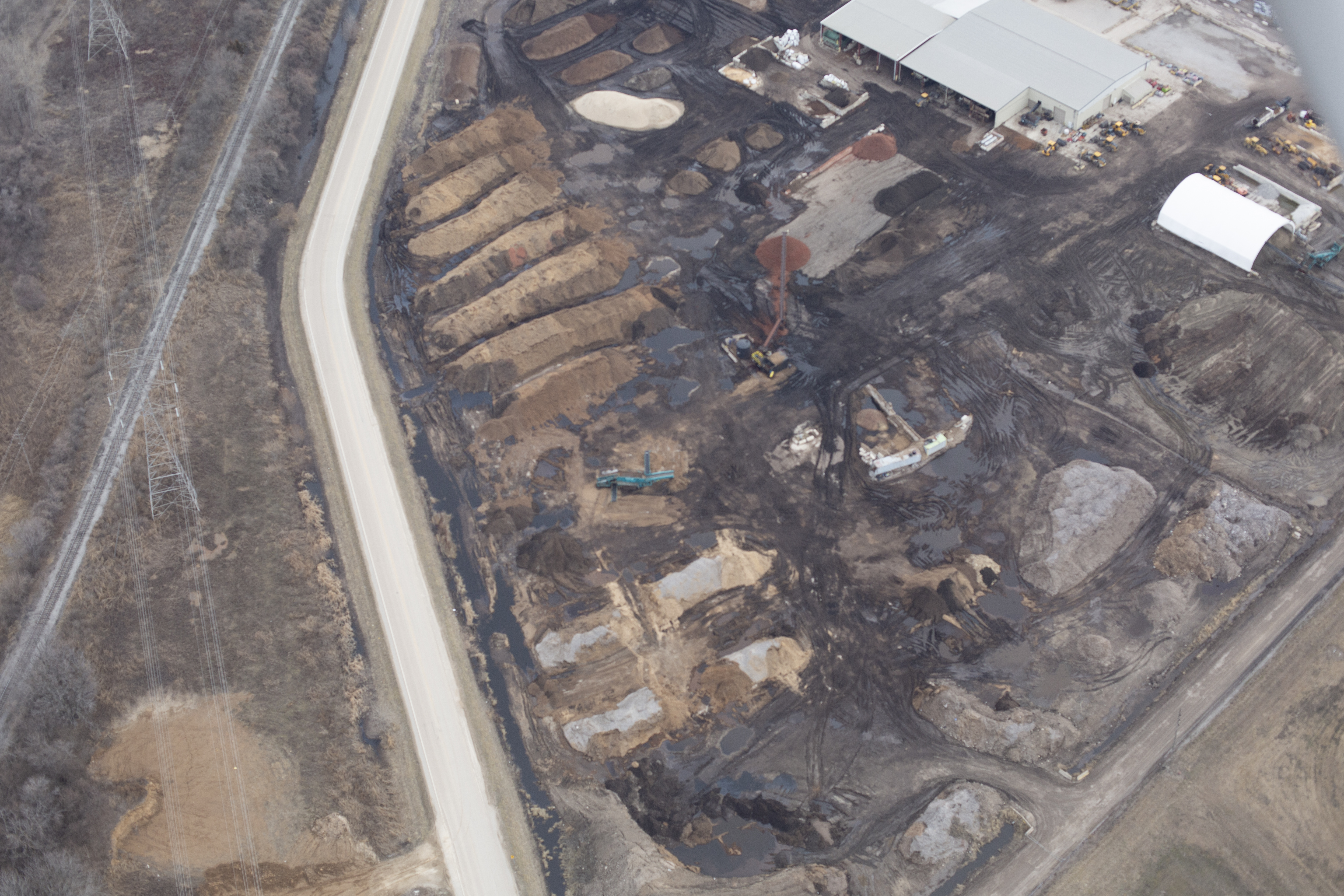
Thermal drone services are especially valuable when an organization needs to identify temperature-related patterns across large or difficult-to-access areas. In the St. Louis market, this can apply to commercial roofs, industrial facilities, manufacturing equipment, solar installations, utility assets, warehouses, institutional buildings, and expansive properties where manual inspection is time-consuming or potentially disruptive.
A thermal drone can help identify roof areas that may be retaining moisture beneath the membrane. It can help reveal uneven heat signatures that may point to insulation breakdown or other building-envelope concerns. It can support inspection efforts around HVAC performance, electrical components, and heat-producing systems. On industrial sites, it can assist in spotting abnormal heat behavior that may warrant closer review by facilities or maintenance personnel.
The value here is not simply in flying a drone with a thermal camera. The real value comes from collecting the imagery under the right conditions, with the right flight planning, timing, angle, and sensor interpretation strategy. Thermal work requires an understanding of surface behavior, environmental limitations, and the difference between useful data and misleading readings. Reflections, weather conditions, time of day, building materials, and operational variables all affect the final output. That is why organizations should work with experienced teams that understand both production quality and technical capture discipline.
Common Uses for Thermal Drone Services in St. Louis
Thermal drone imaging can support a wide range of commercial applications. Roofing consultants and property managers can use it to assess large roof systems more efficiently. Facility managers can use it to help document energy-related concerns or identify unusual thermal signatures in large structures. Industrial operators may use it to review equipment zones, monitor heat concentration areas, or support preventive maintenance planning. Schools, hospitals, municipalities, and institutions can benefit from aerial thermal documentation for campuses, infrastructure, and large building footprints.
There is also value in the communication side of thermal imaging. Decision makers often need to show boards, stakeholders, clients, investors, or maintenance teams why a condition matters. Thermal visuals can be far more persuasive than written notes alone. A cleanly produced thermal image sequence, combined with standard aerials, annotations, and edited deliverables, can help transform a technical finding into a more understandable visual presentation.
That matters because business decisions are often made faster when the issue is clearly seen.
LiDAR Drones and Why They Are Different
LiDAR is often discussed alongside photogrammetry, but the two are not the same. Photogrammetry typically uses overlapping photographs to reconstruct surfaces and generate 3D models. It is highly effective in many situations and is a powerful tool when conditions are favorable. LiDAR, however, actively emits laser pulses and measures their return, which allows it to capture spatial information with a different level of consistency in many demanding environments.
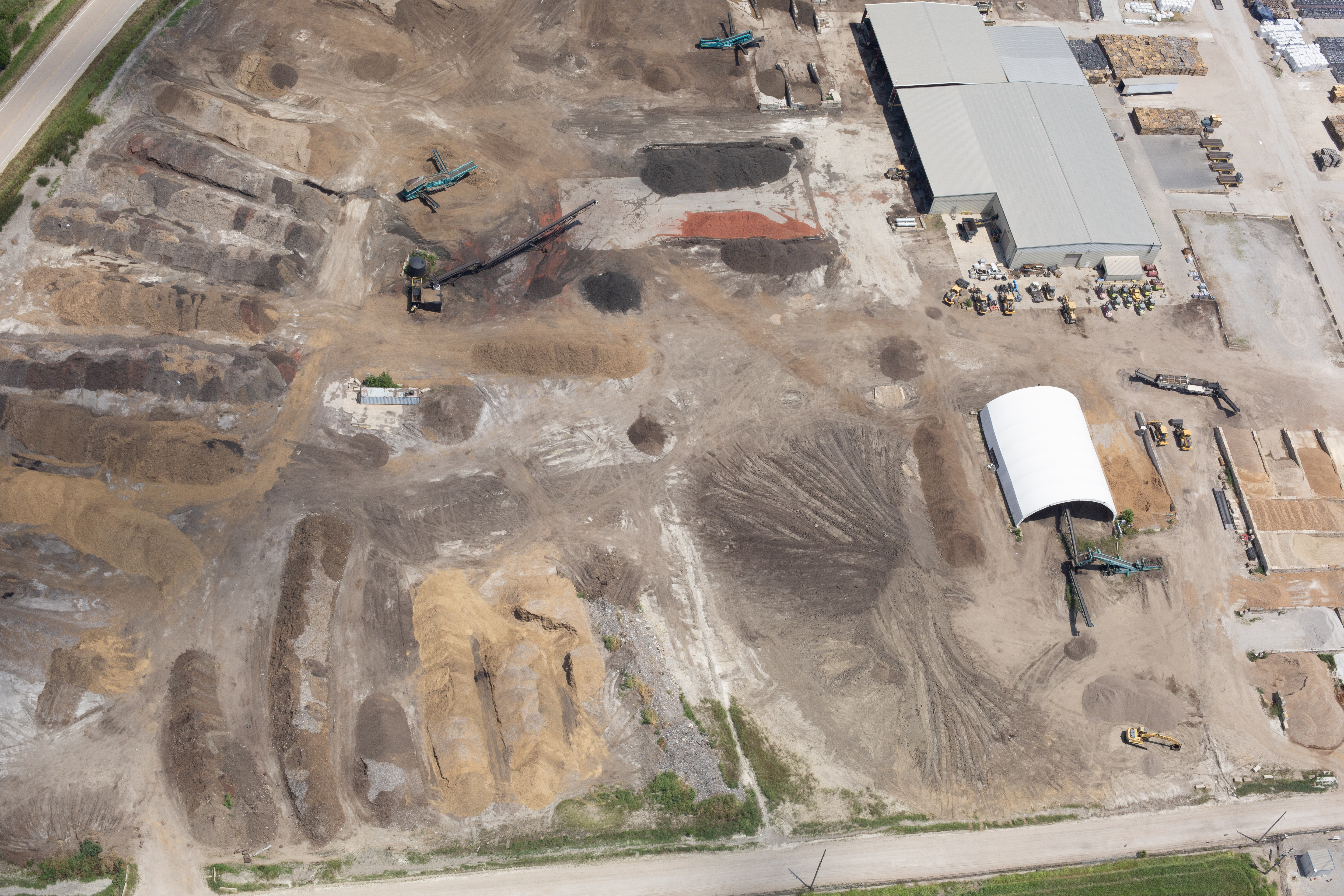
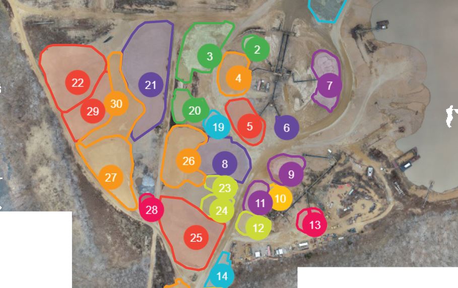
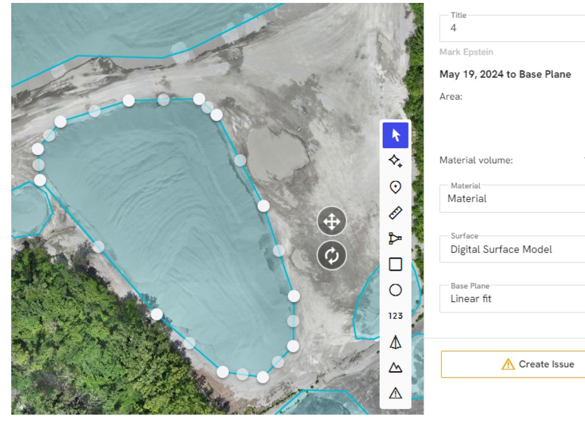
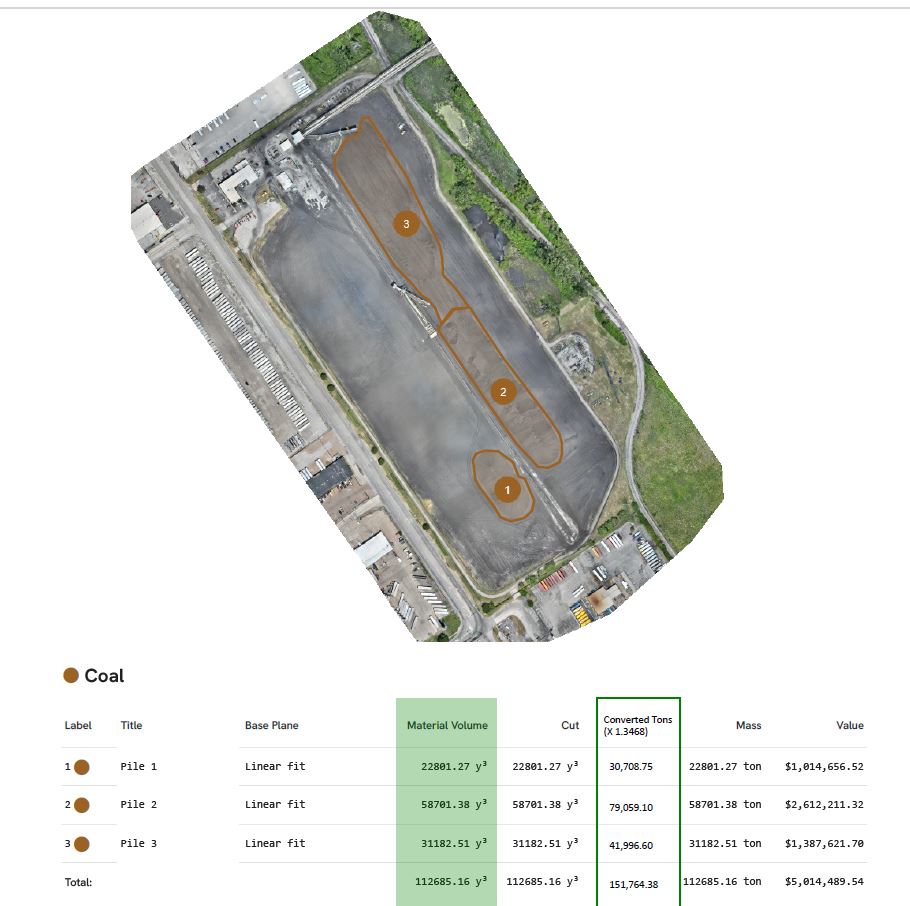
For construction sites, land-development teams, civil planners, engineers, and infrastructure stakeholders in St. Louis, LiDAR can support topographic documentation, corridor mapping, grading analysis, stockpile measurement, route planning, and terrain modeling. It is especially useful where surface complexity, vegetation, or site scale make traditional documentation methods slower or less efficient.
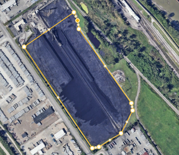
LiDAR data can help organizations better understand the physical reality of a site before design, during construction, or after project completion. It can support decision-making with measurable outputs rather than broad visual impressions. That is particularly important when project teams need dependable terrain information, surface elevation data, or 3D spatial context to inform planning and reporting.
LiDAR Applications for St. Louis Businesses and Organizations
Across the St. Louis area, LiDAR drone services can serve construction firms, developers, engineering groups, municipalities, utility operators, industrial property owners, and organizations responsible for large land tracts or facilities. A construction team may need recurring site documentation to monitor grade progress, drainage paths, material movement, or staging changes. A municipality may need mapping support for infrastructure corridors or property analysis. A developer may want a clearer understanding of the site before planning improvements. Industrial operators may need measurable documentation of large outdoor properties, storage yards, or operational spaces.
LiDAR can also be extremely useful in producing visuals that serve more than one department. Operations may need the measurements. Engineering may need the terrain model. Marketing may need branded visual assets that show the project scale and technical sophistication. Leadership may need presentation-ready graphics that explain what is happening on the site. When the drone provider understands both technical acquisition and media production, the resulting deliverables can be much more useful across the organization.
That cross-functional value is one of the most overlooked advantages of professional drone work.
Thermal and LiDAR Are Not Just for Inspection Teams
A common mistake is to think of thermal and LiDAR drones only as engineering or maintenance tools. In reality, these services can also strengthen communications, business development, documentation, and brand positioning. For example, a company involved in construction, utilities, logistics, industrial services, commercial real estate, or facility management can use drone-collected thermal or LiDAR-supported visuals in proposals, case studies, presentations, website content, recruiting materials, investor communications, and internal reporting.

Today’s organizations need content that does more than look good. They need content that explains capability, proves process, and supports trust. Advanced drone imaging can help do that. A visually strong case study showing thermal roof analysis, infrastructure monitoring, site measurement, or terrain mapping immediately communicates technical competence. For companies selling complex services, that kind of content can be a genuine marketing asset.
This is where the line between technical capture and visual storytelling becomes especially important. The best drone production teams do not simply gather data. They help shape that information into usable media.
Choosing the Right Drone Production Partner
When evaluating drone providers for thermal and LiDAR work in St. Louis, organizations should look beyond whether a company merely owns the equipment. Hardware matters, but experience matters more. Successful thermal and LiDAR projects depend on mission planning, site understanding, safety awareness, regulatory compliance, environmental judgment, capture timing, sensor handling, and post-production workflow. The provider should be able to discuss not just the flight, but the purpose of the flight, the intended output, the end user, and how the deliverables will be used.
That includes understanding file compatibility, data handoff, media formatting, editing requirements, stakeholder presentation needs, and downstream production uses. A company may need raw data, processed visuals, edited video, still images, overlays, marketing-ready presentations, or repurposed content for multiple platforms. A capable team should be prepared to support that full spectrum.
It is also important to work with a provider that understands the business context behind the flight. A facilities team needs something different than a marketing department. An engineer needs something different than a brand manager. A creative agency needs something different than a contractor or municipal client. The right production partner knows how to adapt the approach accordingly.
The Value of Combining Technical Drone Capture with Media Expertise
One of the greatest advantages of working with an experienced video and photography production company for thermal and LiDAR drone work is that the project does not end with raw capture. Instead, the technical content can be integrated into broader communication and marketing strategies.
That means thermal imagery can be paired with standard aerial footage, ground-based video, interviews, graphics, narration, animations, and edited case-study content. LiDAR-driven site visuals can be incorporated into project updates, investor decks, website banners, branded presentations, sales materials, and recruitment campaigns. A single capture session can often support operations, engineering, sales, and marketing at the same time.
For organizations trying to maximize return on production spending, that is a major advantage. Instead of commissioning one vendor for inspection imagery, another for corporate video, and another for marketing visuals, it can be far more efficient to work with a team that understands both the technical and creative sides of the work.
Why St. Louis Organizations Are Expanding Their Use of Drone Technology
The St. Louis region includes a broad mix of industrial properties, corporate campuses, logistics sites, transportation networks, manufacturing facilities, construction projects, institutions, and commercial real estate. Many of these environments are large, operationally active, or difficult to fully understand from the ground. Drone-based thermal and LiDAR services help decision makers capture clearer information while reducing guesswork and improving visual communication.
They also fit the reality of modern business. Teams need faster assessments, stronger visuals, better documentation, and assets that can be reused across departments. Drones support all of that when deployed with purpose and experience. For businesses that want to improve inspections, strengthen planning, support facility decisions, or create more compelling visual communications around technical work, thermal and LiDAR drone services represent a smart and increasingly practical investment.
Experienced Thermal and LiDAR Drone Production in St. Louis
At St Louis Video Production Studio, we understand that advanced drone services must do more than create interesting visuals. They need to deliver meaningful results for businesses and organizations that depend on clear information, dependable production, and professional execution. As a full-service professional commercial photography and video production company, we bring the right equipment, creative crew, and service experience for successful image acquisition.
St Louis Video Production Studio offers full-service studio and location video and photography, as well as editing, post-production, and licensed drone services. We can customize your productions for diverse types of media requirements, whether you need technical aerial capture, polished marketing visuals, presentation-ready deliverables, or multi-use content that supports operations and communications alike. Repurposing your photography and video branding to gain more traction is another specialty, and we are well-versed in all file types, styles of media, and accompanying software. We also use the latest in Artificial Intelligence for all our media services.
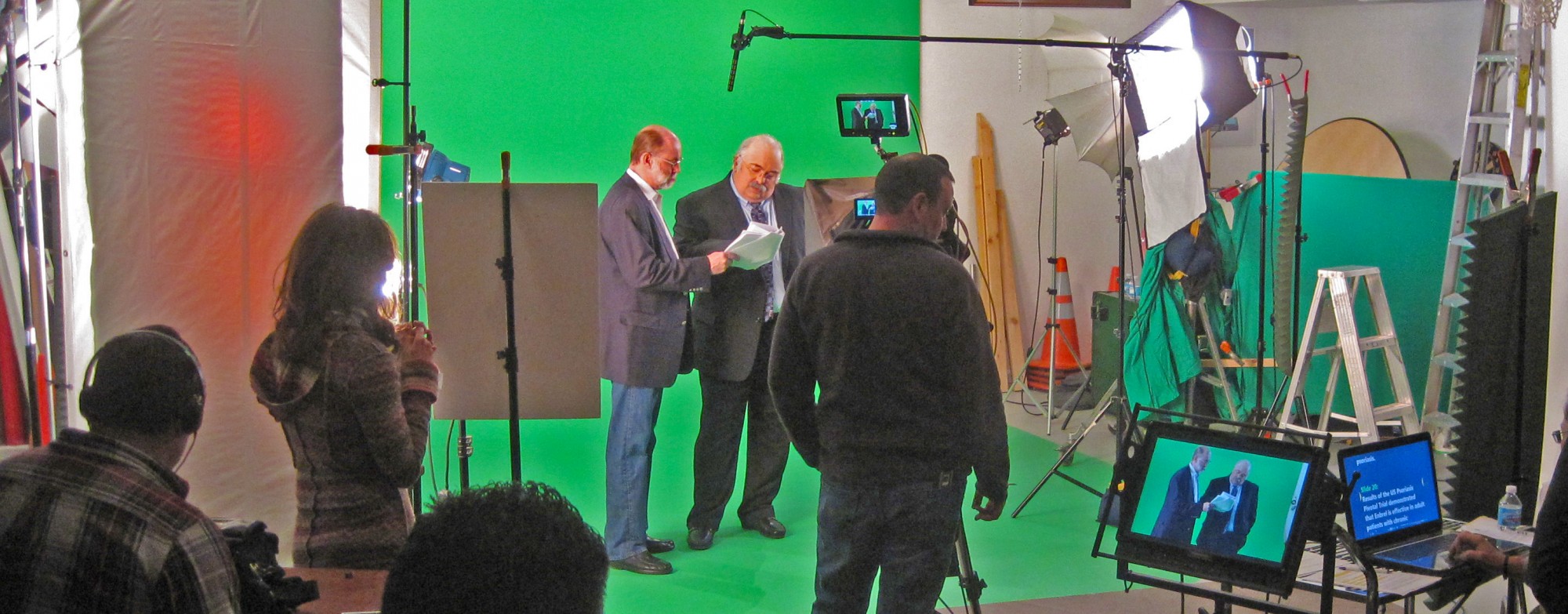
Our private studio lighting and visual setup is perfect for small productions and interview scenes, and our studio is large enough to incorporate props to round out your set. We support every aspect of your production, from setting up a private, custom interview studio to supplying professional sound and camera operators, as well as providing the right equipment, ensuring your next video production is seamless and successful. We can fly our specialized drones indoors. Since 1982, St Louis Video Production Studio has worked with many businesses, marketing firms, and creative agencies in the St. Louis area for their marketing photography and video.
For organizations looking at drones for thermal and LiDAR in St. Louis, experience matters. The right partner helps you gather the images, data, and media assets you need, then turns them into deliverables that are useful, professional, and aligned with your broader goals. That is the level of production St Louis Video Production Studio is built to provide.
Rob Haller 314-604-6544
